Tuesday, January 22, 2013

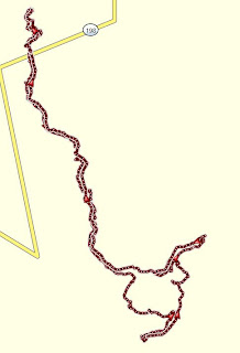
January 22, 2013 - Giant Forest

Title: January 22, 2013 - Giant Forest
Trail head: Giant Forest Museum

 Hike Info:
Trail: Crescent Meadow Road
Destination: Crescent Meadow
Actual Destination: Moro Rock, Tunnel Log
Distance: 5.7
Travel Time: 4:18 (1.33 mph)
Moving Time: 2:55 (1.95 mph)
Elevation Rise: 819'
Maximum Elevation: 6,628'


Description:
Since the weather has been so good, the General's Highway between Grant Grove and Giant Forest is open. So we decided to go snowshoeing up the Crescent Meadow road. This is the same place which Steven and I took David and Rachel a couple of years ago. Steven got a new pair of snowshoes from Costco. So this is there first use.

We left Fresno at 8:40 and got to Giant Forest around 10:40 and left the car at 11:00. There was a short amount of icy pavement on the road, until we left behind the ranger's residence. Then there was snow and the walking was easier. But it had been well walked-some of packed, some of post-holed. But doable with our snowshoes.


The day is pleasant, not overly warm-Steven is in a T-shirt and I shed a layer of clothes. Our first stop is the Auto Log where we take pictures. Then we head back to the road and continue up towards the junction with the Moro Rock Loop. Instead of going around the loop, we head up a trail towards Moro Rock. We did the same thing a couple of years ago, except this time, instead of bearing right and hitting some cliffs, we go left and hit part of the Soldiers Trail. We take this eastward, going past the Roosevelt Tree and hit the road a short ways from the Moro Rock parking lot.


At the parking lot, we stop and have lunch-peanut butter and Nutella, of course. We take about half an hour. During this time, a family of five from Australia come down the stairs. After lunch, Steven decides to go up the stairs to Moro Rock for about 15 minutes. He made it up high enough to enjoy a view, but with the snow and ice, it was better not to go to the top. Looking at him come down, he was making sure that he did not slip-slow and steady. He does make it down safely.

On top of the Auto Log
Looking towards Mineral King


Moro Rock


We go eastward around the loop. We come across another segment of the Soldier Trail. I go over the side and follow it, while Steven and Sherri follows the road. The trail, even though it is close to the road, it seems like it is in a different world. The snow is mostly unbroken, except for another set of snowshoe tracks. The Sequioa's standing around me are just awesome. But after going a ways I decide to work my way back to the road. My way was shorter, but more strenuous, breaking fresh snow. They are about 10 minutes behind me.

Steven's Friend
Tunnel Log
We decide to continue on to the Tunnel Log, only about half a mile further. We find a snow bear there, smiling at us. It is turn around time and we head back at a pretty reasonable pace. The car finds us round 3:00. We then have dinner at Bear Mountain Pizza, well satisfied.


Friday, January 18, 2013

Jan 18, 2013 Snowshoe Redwood Canyon Road

Title: Jan 18, 2013,Snowshoe Redwood Canyon Road
Trail head: Quail Flat Jct
Hike Info:
Trail: Redwood Canyon Rd from QuailFlat
Destination: Redwood Canyon Trailhead
Actual Destination: Someplace on theroad
Distance: 2.5 miles
Travel Time: 1:49 ( 1.38 mph)
Moving Time: 1:20 (1.88 mph)
Elevation Rise: 614'
Maximum Elevation: 6,975'
Minimum Elevation: 6,450'
Description:


The morning did not start out as too promising. The weather was not the issue—it was bright and beautiful. But we were getting a late start. Planned to leave by 9am, but we were just waking up by then. Sherri fixed us sourdough waffles—tasted pretty good. Then we puttered around and did not leave Fresno until 10:30am. So we got to Quail Flat close to Grant Grove just before noon.


During the summers, Quail Flat is the shortest way to Hume Lake.But during the winter, it is just a big parking lot. Across the General's Highway is the road down to the Redwood Canyon Trailhead.When we get there, we notice that the Redwood Canyon Rd had been traveled by some sort of four-wheel drive vehicle—leaving a couple of nice, not too deep, ruts. So down the road we went. Steven was onNordic skis. Sherri and I decided to use snowshoes. Well, down is the right term. We descended about 600'. Steven had the tougher time because of the ruts. It restricted is ability to maneuver. Sherri and I just lopped on.


About halfway through Big Baldy poked its snout out. It makes astatement that it is there, dominating the southern horizon. Besideit is Redwood Canyon. After traveling about 45 minutes, we came uponSteven, having stopped for a bite to eat. We decided to turn aroundthere and travel back up the road the same way we came. We probablywere about half of a mile away from our destination when we turnedaround. We got back to the car at 2:30, content with the day.


This was the first opportunity to use the GoPro camera which my brother got be for Christmas. I wore it with the forehead strap and set it to take pictures every 60 seconds. The pictures came out pretty clear with good resolution. The composition was a bit helter-skelter. Not many just facing the ground. The strap was tight at the start, but after loosening it up, was comfortable.


Friday, January 4, 2013

January 4, 2013 Skiing to Big Meadows

Title: January 4, 2013 Skiing to Big Meadows
Trail head: Big Meadows Winter Parking Lot
Hike Info:

Trail: Big Meadows Road
Destination: Big Meadows Warming Station
Actual Destination: Big Meadows Summer Tailhead
Distance: 7.4 miles
Travel Time: 3:17 (2.25mph)
Moving Time: 2:51 (2.60mph)
Elevation Rise: 639'
Maximum Elevation: 7,817'
Falls: 2 by Gary
Calories Burned: 2,883
Average Heart Rate: 143
High Heart Rate: 162


Description:
Sherri is sick, or at least getting over a sickness. So Steven and I took off cross-country skiing to one of our old stand-by places: Big Meadows, close to Grant Grove. It is a fine, beautiful day, unlike when we took my brother and Andrea up there a couple of years ago.


Being the first ski of the season, we, or should I say, I am, a bit wobbly. Anyway, we enjoy ourselves as we go along the ski tracks. A bit up, a bit down, with two real downs for me, but no face plants. We get to the Big Meadow warming hut. Today it is not needed, but it is a good place to sit down for a few minutes, and that is what we do. We have a Clif bar and then continue on.


We decide to continue on up the road for another mile to the Weaver Lake trailhead. Getting a bit hungry, we turn around and back we come. Nothing very spectacular. But just a plain old good day of skiing.